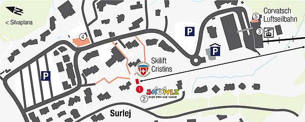
1 Ski school office Surlej, Talstation (bottom station) ski lift Cristins 2 Kinderland Cristins-Surlej 3 Corvatsch Talstation (bottom station) 4 Skiservice Corvatsch 5 Intersport Rent-Network Engadin - St. Moritz
Sils Maria
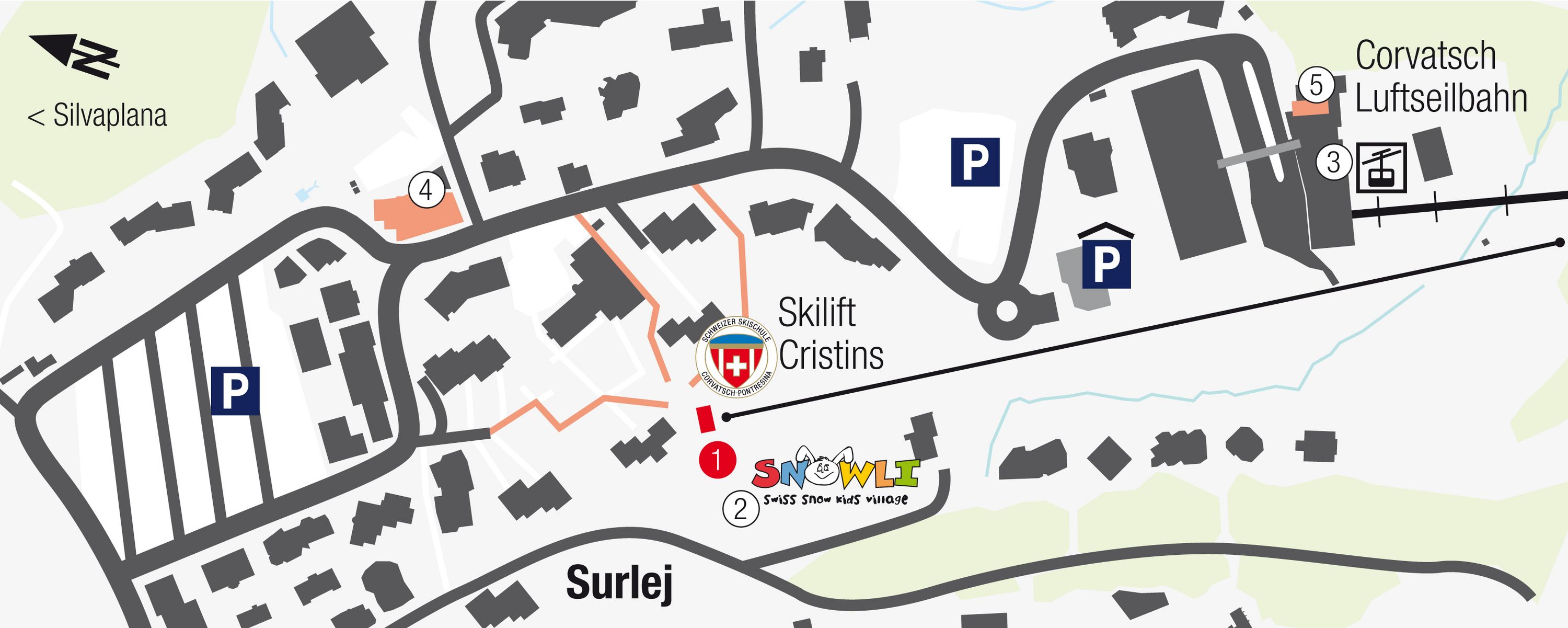
1 Ski school office, Tourist Information, ATM 2 Kinderland Sils Maria 3 Post Sils Maria, pick up service to Furtschellas, Surlej, Maloja 4 Municipal hall (Chesa Cumünela) 5 Meeting point cross-country ski school 6 Giovanoli Sport 7 La Fainera Sport 8 Pick up service to Furtschellas middle station
Maloja
1 Post Maloja / Maloja Tourist Information 2 Kinderland Maloja 3 ATM 4 Giacometti Sport Maloja 5 Sidewalk to Kinderland Maloja
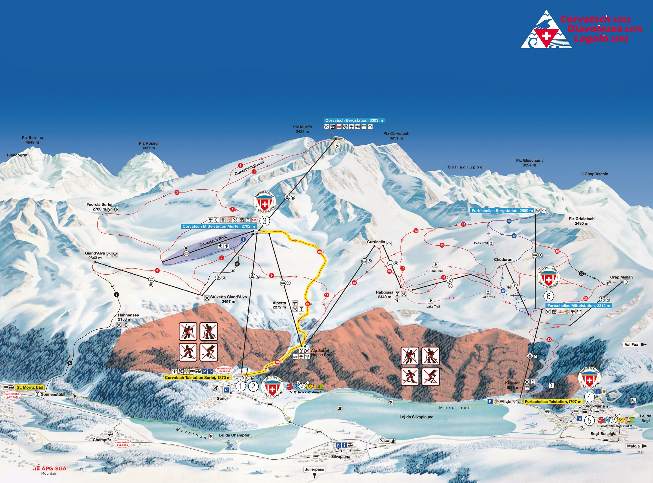
1 Ski school office Surlej 2 Kinderland Surlej with «Snowlino», lunchtime care for children 3 Corvatsch Mittelstation (middle station) 4 Ski school office Sils Maria, Sils Tourist Information 5 Kinderland Sils Maria with «Snowlino», lunchtime care for children 6 Furtschellas Mittelstation